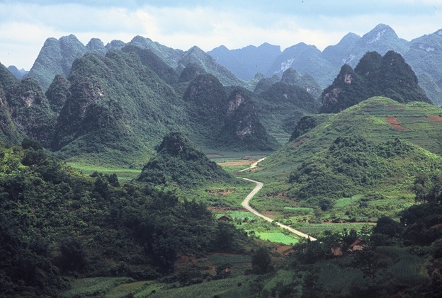
Because it’s remote, you’ll need to arrange transport there. Getting to Ha Giang can be a blast or a chore depending on how you do it.
The Ha Giang Loop is becoming increasingly popular in the Vietnam motorbike tour scene. What was once a hinterland backwater province has drawn significant numbers of tourists over the past few years. For many, it’s one of the highlights of their Vietnam trip.
We’ve had a fair few questions come our way about the Ha Giang Loop, so we’ve written this guide to accompany it. Follow along as we go over the ins and outs of the Loop so you know what it’s got to offer.
Table of Contents
How to Get To Ha Giang?
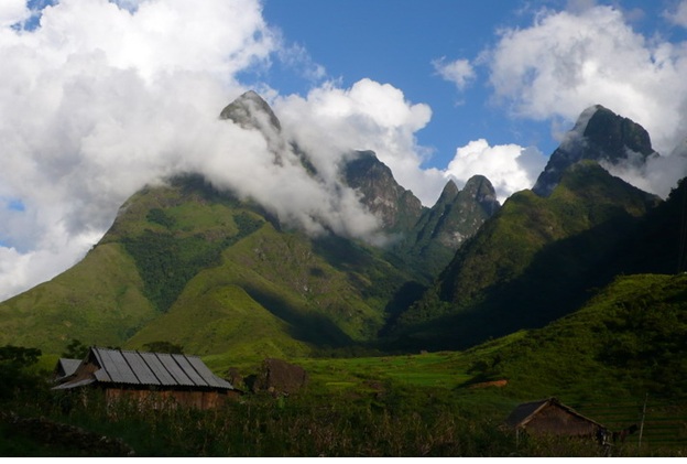
Ha Giang is a truly remote part of Vietnam.
First, it’s important to note that there is neither an airport nor a train station in Ha Giang. Consequently, motorized, wheeled transport is the only way in or out unless you feel like a very long hike or bicycle ride. As they say, everywhere is within walking distance if you have the time.
Typically, visitors will take a bus or private car from Hanoi to Ha Giang. A bus will take somewhere in the vicinity of 6 hours and cost around $10. A private car will cost more but will get you there more comfortably and often more quickly. Prices are often negotiable and will cost more than the bus.
Another option is to take a train to Lao Cai before taking a bus or hiring a car to Ha Giang. This option is reasonable if you want to include Lao Cai and Sapa in your trip as well as Ha Giang.
Once having arrived by to Ha Giang, many travelers will rent a bike there to complete the loop and put that feather in their cap. You can rent and return the bike in Ha Giang once you’ve finished.
Of course, our favorite option is to travel to Ha Giang by motorcycle. Whether you’re coming from Hanoi or elsewhere, you’re certain to be impressed. The north of Vietnam has an abundance of scenery and culture to offer: it’s almost impossible to overstate just how impressive the region is.
Ha Giang Loop Typical Route and Highlights
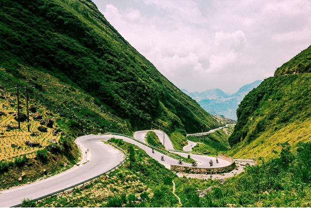
The Ha Giang Loop is full of steep climbs and hairpin turns. Image credit: Quang Anh Vũ
The most common route is to travel north out of Ha Giang before circling back to the town. This route is common because many people view the loop as a standalone motorbike trip rather than a part of a larger Vietnam motorbike trip. The loop can take anywhere from a few days upwards depending on the amount of ground you want to cover in a day, the number of spots you wish to take, and the overall time you have allotted on your trip. Most typically, it’s three days though it can easily be stretched longer.
Ha Giang to Quan Ba
The first notable stop north of Ha Giang is Quan Ba. It’s a short 63 kilometers that can be covered in a couple of hours along winding roads climbing into the mountains. If you intend to take it slow, this can be your first stop along the trip. Those who prefer to cover more ground can stop here for a breather and some sightseeing before continuing on.
Quan Ba offers a fair amoung fo visitors to see. Its steep mountains and emerald-green rice paddies are iconic in the region. The scenery includes the famous ‘fairy mountains’ which resemble breasts, much to the amusement of many visitors.
The region features ‘Heaven’s Gate,’ the border marker that previously denoted the end line of French rule and the beginning of local control by the Hmong people. Heaven’s Gate remains a notable tourist attraction to this day. A stop at the cafe at the top of Heaven’s Gate is well worth it for the spectacular view it offers.
Caves abound in Quan Ba as well, including the always-empty Lung Khuy cave notable for ancient limestone formations. While these caves are a bit spread out, they’re worth it for cave enthusiasts since they’re not major tourist attractions and have yet to experience any degree of mass tourism.
Finally, the region is home to a number of ethnic minorities, including Hmong, Dao, Tay, and the only-found-in-Quan Ba Pu Y people. These tribes retain a great deal of their traditional culture and are quite distinct from mainstream Vietnamese society.
Quan Ba to Dong Van
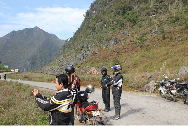
Narrow roads and steep cliffs make riding the Ha Giang Loop an unforgettable adventure.
Dong Van is the next notable stop after Quan Ba. The town lies in the heart of the eponymous Dong Van Karst Plateau — a UNESCO Global Geopark designated in 2010. This region is one of the true highlights of Vietnam in general. Sharp, pointed mountains gashed by equally sharp, narrow valleys make for an otherworldly scene that rivals any natural wonder on Earth. The vast majority of the area is limestone that has been eroded by eons of rain and wind, leading to the wonder that it is today.
Dong Van Highlights
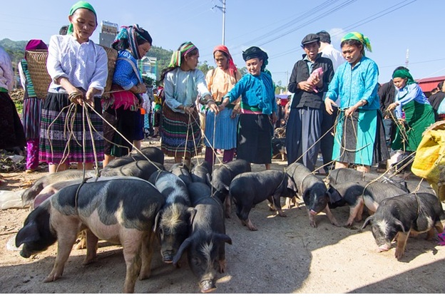
Locals gather to trade livestock at the market in Dong Van.
The town of Dong Van itself features an old market where local tribes gather to trade goods. The bright, colorful clothes worn by the locals often awe tourists. Note that locals wear them earnestly rather than to amuse tourists. The town itself is a market town that locals have been trading in for quite a while now — exactly how long few can say.
There’s also a new ‘ancient street’ featuring handmade goods from the local hill tribes. This market is clearly oriented towards tourists rather than locals, but it’s worth a visit anyway for some unique souvenirs.
Outside of the town and on top of a hill is an old French fort known as Don Cao Fortress. The French used the high ground to control the area. The road leading up to the fortress is very steep and we can’t recommend driving up it as it’s dangerous. On top of being dangerous, it’s illegal to drive to the top, though some still do. Walking is the only way up, but it’s a significant hike.
Additionally, outside of town is the Hmong Royal Palace. The Palace was built at the beginning of the 20th century and remains a valuable tourist destination to this day.
For those with a keen eye for geology and paleontology, the Dong Van Plateau is home to countless fossils — marine fossils, to be exact. For millions of years, this region was a seabed before being lifted up by tectonic forces. Keep an eye out and you may spot plenty of fossils.
Further afield, to the north of Dong Van is Lung Cu Tower — the northernmost point in Vietnam. This spot is certainly worth a visit as it gives a spectacular vista into the southern reaches of China. A trip along the Ha Giang Loop is essentially incomplete without visiting the Lung Cu Tower.
The Ma Pi Leng Pass
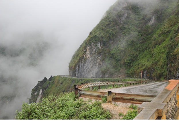
The Ma Pi Leng Pass road clings to the side of the mountain.
The next major stop along the Loop is the Ma Pi Leng Pass, situated between Dong Van and the town of Meo Vac. The Pass sits at an impressive 1,500 meters above sea level. The road barely clings to the side of the mountain along the pass, making one wonder how workers built the road. There are essentially sheer, 90-degree cliffs to the side of the road, adding no small degree of adrenaline to any drive along it.
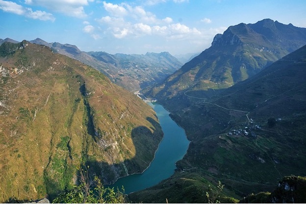
The Ma Pi Leng Pass features a steep gorge with a river running through it.
Along with the sheer cliffs, countless hairpin turns and steep gradients make this one of the most exciting roads in the country to drive. Riders will want to take any opportunity possible to snap some photos. With clouds often capping the mountains and a river running in the steep valley below, there’s no other place like this on Earth.
Near the top of the pass are a few coffee shops and homestay options if you wish to extend your journey here. At the very least we recommend stopping at a coffee shop to take in the view.
Back to Ha Giang — or Further Afield
After crossing through the Ma Pi Leng Pass and carrying on through Meo Vac district, you’ll encounter the QL34 highway. You can choose to go east or west here. West will take you back towards Ha Giang, completing the traditional loop.
Heading east will take you towards Cao Bang, which has its own set of spectacular sights. If you’re on a longer north Vietnam motorbike trip, this is a good option to continue onwards.
Whichever direction you choose depends on your plans, goals, time, and budget.
Alternate Roads Within the Loop
The route we’ve laid out above covers the main roads: the “QL” (national highway) designated roads, which form the core of the Loop. However, several other, smaller highways bisect this loop and offer their own unique set of charms. Generally, these roads are lesser traveled and may feel more exotic and wild. If you see a road designated “DT,” the road will be in good condition — certainly tarmac, though usually two lanes.
One could make the Loop into a much longer journey than just a few days without approaching anything near boredom. Again, it largely depends on your goals and budget in terms of both time and finances.
If your intention is solely to do the loop before moving on to another destination, then treating it as a loop makes sense. If the region is part of a broader trip, however, there are many more options.
Ha Giang Loop Accommodation
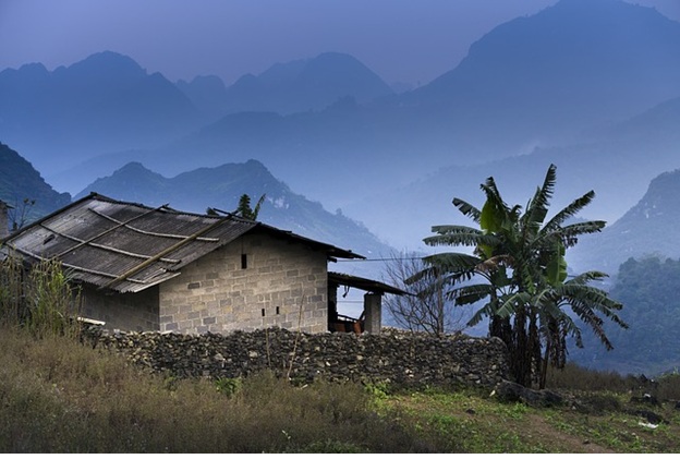
Many homestays will be simple village houses.
Of course, if you’re traveling the Loop you’ll need a place to stay. While you can find guest houses, hostels, and small hotels to some degree, the best way to get an authentic experience is to stay in a homestay. These homestays can be enlightening as well as refreshing since most of them are operated by local hill tribes. In Quan Ba, there is no shortage of homestays: one good example is the Lý Đành Homestay. Near Dong Van, there’s the Dong Van Hmong Homestay. Just north of the Ma Pi Leng pass viewpoint is the aptly named Ma Pi Leng homestay. And in Meo Vac you’ll find the Auberge de Meo Vac Mountain Lodge, less of a homestay but well worth a stop.
Traditionally, most tribal homestays will have one large room divided by either curtains or a thin divider. You’ll sleep on a rather thin mattress that is actually far more comfortable than it may appear at first.
Homestay Food
Most often, the host of the homestay will provide you with dinner and drinks as well as breakfast. And when we say ‘drinks,’ we’re not talking water: the tribes make some strong stuff up in the hills. You may find rice wine, which is a bit of a misnomer since it’s liquor-strength. You may also encounter corn wine, which takes some getting used to and hits like a brick. Often, locals will insist you at least have one drink with them — so steel yourself and be prepared to turn down future offers if you don’t want a hangover.
The local food at tribal homestays will be unsurprisingly more rustic than that found in lowland, mainstream communities. Grilled meat is quite common — often a simple arrangement of chunks of meat grilled over fire. Vegetables and fruits will be whatever is in season.
A brief note: because of its latitude and altitude, Ha Giang can only accommodate one rice harvest per year. However, at the end of the rice harvest, there is time for a quick growing season of a local variety of buckwheat. And when the buckwheat blooms, it’s truly spectacular: pink blooms as far as the eye can see across terraced paddies. Such an event only takes place once a year, usually in October, so count yourself extraordinarily lucky if you manage to see it.
What to Look Out For
We’d be remiss in our duties if we didn’t indicate some potential dangers that go along with riding the Ha Giang Loop. We certainly don’t want to discourage driving the loop — rather, it’s important to be aware of potential pitfalls (no pun intended) before they make an unwelcome appearance.
Ha Giang Loop Weather
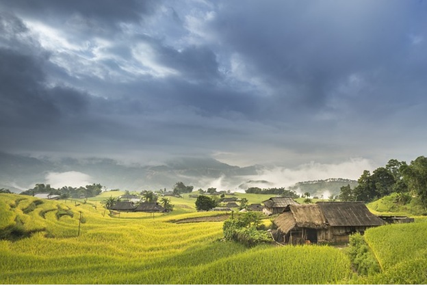
Weather in Ha Giang can be unpredictable.
The region is mountainous, at elevation, and not too far from the coast. That means that clouds and rain are never too far away, and precipitation can happen at any time. Taking wet weather gear is always a good idea.
The wet season is generally June through September. Storms can crop up very quickly among the mountains so it’s important to keep an eye on the clouds. Additionally, because of the steep elevations and cliffs along the roads, landslides are always a possibility. Exercise extreme caution when driving in the rain.
The weather can get quite cold in the winter, from November through February, though the skies are usually clear then. As you’ll be at elevation in cold weather, be sure to bring warm-weather clothes. Vietnam is a tropical country, but it won’t feel like it in the mountains in the wintertime.
Police and Licensing
Plenty of tourists decide to drive the Ha Giang Loop without a license. We strongly recommend against doing so, for several reasons.
First, police can decide to confiscate your motorbike if they stop you and discover you’re riding without a license. There’s little you can do to fight this if they’re so inclined. If you’re renting out a bike, you’ll be in for some hefty fees in addition to a royal pain in the rear. The same goes if you’re riding with a company that isn’t licensed: the cops can stop your trip and confiscate the bike. That’s no fun. Make sure you’re riding with a company that’s licensed.
Second, riding without a license negates the effects of any insurance you may have. For example, if you’ve taken out travel insurance but you aren’t properly licensed to drive, your insurance will not pay out in case of an accident. You’ll be on the hook for any expenses.
Third, police are beginning to crack down nationwide on foreigners driving without a license. The carefree days of tourists or expats driving around the country without a license are nearing an end — and we find it hard to blame the police.
If you’re licensed in your home country to ride a motorcycle, you can get licensed in Vietnam without too much trouble. Contact us and we’ll help you through the process.
Road Conditions
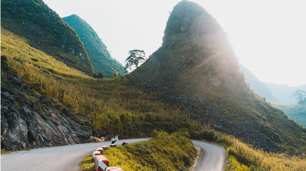
Roads are in good condition but can get washed out in storms.
Some of the roads in the Ha Giang Loop can be treacherous even in the best of conditions. As mentioned above, some of these roads barely cling to the side of mountains. Others may experience landslides or get slippery when wet. And of course, there’s the ubiquitous danger of other reckless drivers on the road. You’ll need to have your wits about you at all times.
We absolutely do not recommend this route for newbie motorbike riders. If you’re an experienced, licensed rider, then great. If this is your first time getting on a bike, however, we recommend you ride pillion or practice elsewhere first. Every year there are tourists who end up hurt or worse on these roads.
Onyabike Adventures’ Thoughts
The Ha Giang Loop is one of our favorite routes in the country, and for good reason. We’ll return here again and again: it just doesn’t get old. The route is becoming increasingly popular so if you’d like to see it before it truly blows up now is a good time to do so. Check out our Sapa and Ha Giang Adventure to see some of the best of Vietnam.