Home > Blog > Destinations > Vietnam Weather
Vietnam Weather
Share:
- Published:
- Updated: 20/01/25

Whether it’s weather fair or foul, the clouds and sun and precipitation a place experiences make a huge impact on its character and overall feel. Scotland wouldn’t be Scotland without its wind and rain; California wouldn’t be California without its sunshine; and Vietnam wouldn’t be Vietnam with, well…with everything Vietnam’s weather has to offer.
Vietnam’s long north-south axis means that different regions of the country experience significantly different weather depending on the season. A sunny day in Saigon could be a wet, chilly one in Hanoi, for example.
As the saying goes, climate is what you expect and weather is what you get. In this article, we’re more discussing Vietnam’s general climate so you know what to expect. Neither we, nor meteorologists, nor deities themselves know for certain what the weather will bring beyond a few weeks away. However, we’ve got to work with what we’ve got.
Good news, though: For those looking to go on a motorcycle adventure tour in Vietnam, the country’s weather offers year-round riding opportunities. Considering the fact that there’s plenty to see in all regions, there is no shortage of killer rides no matter what time of year you plan to visit.
Just as a primer, here’s a broad overview of weather in the country.
Table of Contents
Vietnam Weather Overview
| Month | Northern High / Low (°C)Month | Central High / Low (°C) | Southern High / Low (°C) |
| January | 19/14 (dry) | 26/20 (humid) | 30/22 (dry) |
| December | 22/15 (dry) | 25/20 (rainy season) | 30/23 (end of rainy season) |
| October | 29/22 (less rainy, chance of typhoon) | 30/23 (rainy season) | 30/23 (rainy season) |
| November | 25/19 (dry except for occasional typhoon) | 28/21 (rainy season) | 30/23 (rainy season) |
| February | 20/15 (dry) | 21/26 (less humid) | 32/22 (dry) |
| September | 31/25 (rainy season) | 34/25 (start of rainy season) | 33/25 (rainy season) |
| March | 22/18 (some rain) | 30/22 (dry) | 35/25 (dry) |
| June | 33/26 (rainy season) | 35/27 (chance of rain) | 35/25 (thunderstorms) |
| July | 33/26 (rainy season) | 35/27 (chance of rain) | 35/25 (thunderstorms) |
| August | 31/25 (rainy season) | 35/27 (chance of rain) | 35/25 (thunderstorms) |
| April | 27/21 (some rain) | 33/25 (dry) | 36/27 (dry) |
| May | 31/24 (warm/rain) | 35/25 (dry) | 36/27 (dry) |
Generally, we find it’s most convenient to break the country down into three regions for weather: south, central, and north. Those regions further have their own subsections, but that’s a good place to start. Consider those ‘primal cuts’ that we’ll further break down.
So strap in, sit down, and let’s check out the different weather patterns that affect the country from south to north.
South Vietnam Weather
The weather in the south of Vietnam is what many would imagine a tropical region to be: consistently hot, muggy, and with plenty of sunshine. This is true most of the year, and becomes truer the further south you go.
Residents of Ho Chi Minh City (or Saigon — you can call it either without fear of offending anyone) often joke that the city has three seasons: hot, really hot, and rain. If you were to break those down, they would look something like this:
Hot: December-February
Really hot: March-June
Rain: Mid-June-November
The ‘summer’ months of June-August often witness strong afternoon showers, but it’s hard to refer to this as a true rainy season. Temperatures will climb until well after noon, and then clouds will roll in. The storms can be truly impressive, but they pale in comparison to those witnessed in the real rainy season of September-November.
Even in those days it doesn’t rain all day — it’s more that the storms are strong, frequent, and unpredictable. Every single resident of the city will have a rain poncho in their motorbike during these months.
December and January can be cool compared to other months, but hot compared to other parts of the planet. These months are generally the least humid of the year as well. Despite the time of year, you will essentially never need a jacket in the south of Vietnam — unless you intend to use it to protect yourself from the sun, as the locals do.
The weather in the rest of the south is consistent with that of Saigon. However, the Mekong delta region deserves its own brief mention.
Weather in the Mekong Delta
The Mekong delta region can be summarized as hot ‘n’ steamy essentially year round. They’ll experience essentially the same weather patterns as Saigon but will feel even more tropical, if that’s possible. Because of its year-round warm weather, the region is consistently good for motorbike riding. You’ll likely see significant rain if you’re there in the rainy season, but at least it will be warm rain.
Moving north from Saigon will lead you to the central part of the country — which we’ll cover post haste.
Central Vietnam Weather
Central Vietnam is a huge and geographically diverse region. It stretches all the way from the southern provinces leading up to the Central Highlands to the outskirts of the Red River delta provinces in the north. As such, there’s no way to define the weather in this one region as one unit. Instead, it’s better to break it down into three parts:
The Central Highlands
The southern central coast
The northern central coast
So, with that in mind, let’s dive right in.
Vietnam’s Central Highlands Weather
As the name suggests, the central highlands are, well, high. Their altitude gives them a notable break from the consistently high temperatures experienced at lower altitudes. If you’re sweltering in Saigon or Da Nang, you can assume that it’s at least several degrees cooler in Da Lat, 1500 meters. Because of its elevation, Da Lat rarely gets above 30 degrees celsius and frequently hovers in the teens to low twenties.
Not all cities are at that elevation. Buon Ma Thuot, for example, the coffee capital of Vietnam, is at roughly 500 meters, making it considerably warmer than Da Lat year round.
So, when’s the best time to go? Usually anywhere from November to April, though it can get quite cool (11-12 degrees) at elevation and quite warm at lower elevation (30+ degrees) approaching April. Planning a wardrobe can be complicated, but it behooves you to pack a wide variety of clothing, including jackets and layers. Coming down off of a mountain can mean a spike in temperature, and vice versa.
Just as important as temperature is rain, though. Don’t worry, the Central Highlands have plenty of it.
Know Your Monsoon
What does the monsoon mean for you? Simply put, it means if you’re driving in a province in the middle of the monsoon season, you’re eventually going to get wet. If that doesn’t bother you — and hey, locals deal with it just fine — then cool. But the monsoon is certainly something you need to keep in mind when you’re planning a motorbike adventure ride.
In the Central Highlands, the monsoon pattern trends earlier the further inland you go. The provinces of Dak Nong, Dak Lak, Gia Lai and Kon Tum experience their monsoon season starting as early as May and stretching to the end of October, with a peak in August. Whereas October and November are consistently some of the rainiest months in most of the south of the country, in these inland provinces they are considerably drier.
Although Da Lat sees rain more consistently than many Vietnamese provinces throughout the year due to its elevation, it still follows the established southern pattern of a peak in the monsoon season around September-October.
Vietnam’s South Central Coast Weather

Defining exactly where the south central coast ends and the north central coast begins. However, conventional wisdom — the view we’ll take — is that it begins in Khanh Hoa province, home to Nha Trang, to the city of Da Nang. Being on the coast, the monsoon is very noticeable and on average dumps more water on the region than it does further inland.
Significant differences in weather exist between the southern part of the south central coast (yes, southern south central sounds redundant but we promise it’s not) and the northern south central coast. This is in large part due to the curve of the country: the southern part of the coast, as well as the entire south of the country, are shielded by the country’s bulge into the ocean.
Shielded from what, you may ask? The northeastern monsoon picks up in the winter months, making cities like Quy Nhon, Hoi An, and Da Nang much grayer and colder in the winter than Nha Trang.
South Central Coast Monsoon
In contrast to the south, the weather is far more variable in this region. The dry season usually lasts from January-June, though the rainy season picks up in earnest in September. Rain blown down from cold winds in Mongolia, Siberia, and northern China accelerate along the coast of China and Taiwan before smashing into the central Vietnamese coast. If you see or feel strong northeastern winds — especially from September on — expect rain. And often a lot of it.
Just how much rain, you ask? It can be mind-boggling: In December of 2018, the city of Da Nang ‘enjoyed’ 635 mm (25 inches) of rain in 24 hours. That wasn’t a tropical storm — just the aforementioned monsoon.
That certainly is beyond normal, and was rare enough to be memorable. But it can give you an indication of just how strong the monsoon can be. If you’re coming to this region between September and December, pack a raincoat and as much waterproof or water resistant gear as you can.
A note: the last two years, as of this writing (2020) have seen markedly less rain during the rainy season than in previous years. This was to such an extent that central provinces Experienced water shortages the following summer, as mountain reservoirs had not been filled.
On the one hand, this led to a spate of spectacularly sunny and pleasant weather in October and November, usually wet months. On the other hand…water shortages and drought. Tough choice. Luckily, no one was actually making that choice.
Tropical Storms
Temperature variation south to north
In the summer and dry months, it’ll be warm throughout the region — approaching ‘quite hot’ in the months of May-August, when temperatures can reach the high 30’s. From March until October, you can assume that the entire region will be warm and you won’t need a jacket.
After October, things change. The further north you go, the cooler it gets. The cities of Da Nang and Hoi An can be surprisingly chilly in December, January, and February, especially when you take into account the humidity and lack of home heating or insulation. Nha Trang and other regions further south are warmer, but can still see cold snaps. If you’re traveling through the south central coast in these months, you’ll need to bring a jacket, long pants, and other warm clothing.
Especially consider that crossing mountains and climbing in elevation will see temperatures drop, and you’ll find yourself very thankful you’ve brought warm clothes.
Vietnam’s North Central Coast Weather
Everything said about the south central coast’s weather applies to the north — except moreso. The wets are wetter, the colds are colder, and the hots are hotter.
The monsoon months follow the same pattern as the south: The wettest months are September and October, with considerable rain until at least January.
The region’s provinces have recently been subject to more tropical storms than their southern brethren. For whatever reason, storms approaching the coast have often taken a sharp northern turn — dashing into the coast in provinces like Nghe An or Thanh Hoa.
What’s more, due to the region’s nearer proximity to China, cold fronts approaching from the north push into these provinces with less resistance than those further south. This means cold snaps are longer and stronger.
In the mountains, like in most regions of the country, rainfall is greater than at sea level — no surprises there. It’s simply something to keep in mind when traveling through the region.
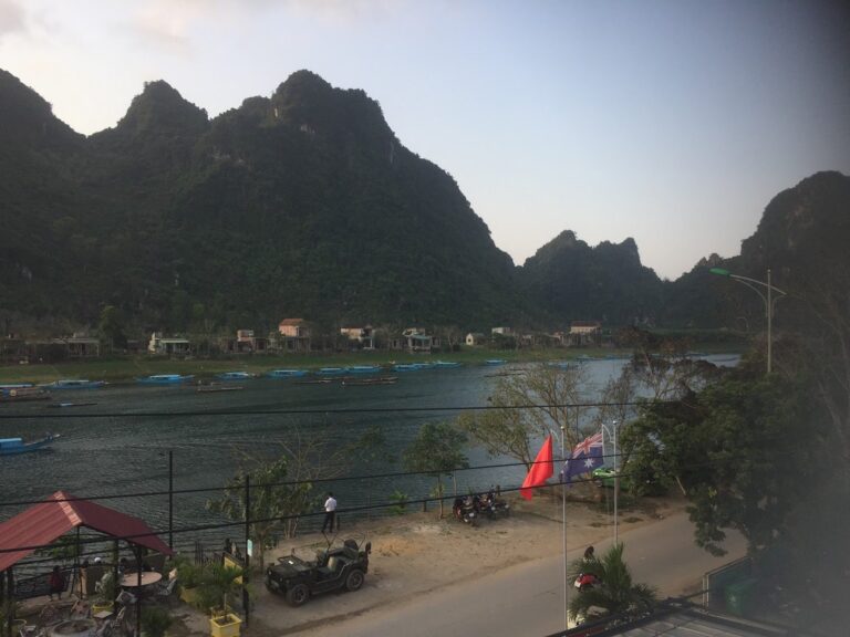
The north central coast still boasts some spectacular weather through a large part of the year, which is why it’s one of our favorite regions to travel through. It includes such gems as Phong Nha / Ke Bang National Park, one of the crown jewels of the whole country.
If you’re traveling in this region from September-November, bring wet weather gear. If you’re there from November-March, bring warm clothes. If you’re there from March-September, bring sunscreen.
North Vietnam Weather
The weather in northern Vietnam experiences much more variation than can be found in the southern stretches of the country. While its monsoon season more closely matches that found in the south, its winter acts more like one would expect a winter to act: significantly colder than the rest of the year. It’s this winter that’s arguably the defining feature of the north’s weather when compared to other regions.
Essentially, the north can be divided into two regions: the low-lying Red River delta, and the mountainous regions that surround it. For riding purposes, the northern mountains have some of the Best roads in the country like the Ma Pi Leng pass, part of the Ha Giang Loop. whereas the densely populated flatlands aren’t quite as much fun.
Because northern Vietnam borders China, large weather patterns originating as far north as Mongolia and Siberia play a large role in the region’s climate. A cold front that makes snow in Shanghai, for example, will show up in Hanoi a few days later as wind and rain. So, if you’re following weather, pay attention to the weather in China as well to get an advance picture of what will happen in northern Vietnam.
Red River Delta Weather
The Red River delta — which is the historical heart of Vietnam — has generally hot, muggy summers and cool, cloudy winters punctuated by occasional storms. The heat of the summer coincides with the rainy season: May to October are both the hottest and wettest months, with temperatures steadily reaching into the 30’s celsius and sometimes pushing 40. June-August are consistently the hottest months, like summer in higher latitudes.
The statistics would tell you that October-December see a significant drop in rainfall, but the region can still be hit by an errant tropical storm. Tropical storms often turn north once crossing the Philippines and entering the East Sea (or South China Sea, depending who you ask), landing a direct blow on the delta. It’s impossible to predict if and when one of these storms will hit, so essentially don’t worry about them. There’s not much you can do and the region is largely prepared for them.
One thing many travelers aren’t prepared for is the cloudiness of the late winter. The period of January-March in this region sees very little sunshine — which can be a blessing as well as a curse. If you intend to be riding outdoors all day, you stand much less chance of getting a sunburn.
One reason to bring warm clothes when visiting in the winter is something many westerners are unprepared for. Buildings are generally uninsulated and unheated in Vietnam. So, while 15 degrees celsius may sound perfectly pleasant, recall that it will be 15 degrees celsius indoors as well and you’ll definitely want to wear a jacket.
Northern mountains weather
Much of what has been said about the Red River delta is true about the mountains — except with greater extremes.
As you might expect, for example, areas at high altitude like Sapa or the Ha Giang loop can get truly chilly during winter months — near freezing at times. If you’re traveling through here during the cold season, make sure to bring warm clothes and prepare to dress in layers. The high humidity can increase the effects of both heat and cold, and you’ll want to be able to adapt when necessary.
Similarly, because these regions are mountainous, you can expect significantly more precipitation than at lower altitudes. Storms are stormier and more unpredictable — you can round a bend in sunshine and see storm clouds on the other side. So, in addition to layers be sure to bring wet weather gear as the odds are very high you’ll encounter rain. It’s all part of the adventure.
Onyabike Adventures’ Thoughts
The weather is always part of an adventure no matter where you go, and Vietnam is certainly no exception. Indeed, the weather patterns make a great impact on the character of the country and keep it interesting.
Because of the country’s geography, any time of year is a good time to ride in Vietnam — if one place is in its rainy season, another will be in its prime riding season. And with the wealth of spectacular scenery the country has to offer, you’ll be making the right call to visit no matter when you choose.
Related Posts
Recent Posts


